Forest Service Roadless Rule Proposed Changes
Short version Jan 7, 2025
Background
In the late 1990s, an inventory of so called "roadless areas" was completed by the Forest Service, and in 2001 the Roadless Rule was adopted. The nationwide rule prohibits new road construction, road reconstruction, as well as any timber harvest within the designated roadless areas.
The rule protects 58.5 million acres of national forest across thirty-nine states from Alaska to New Mexico, Oregon to Florida, and of course here in Washington State. In the Darrington Ranger District, there are 107,000 acres of Roadless Area, about 20% of the entire district. (In addition, there are about 300,000 acres of designated federal Wilderness areas in the District. Other nearby lands are managed by the State Department of Natural Resources, DNR.)
What happened
In June 2025, the U.S. Secretary of Agriculture announced that the twenty-four year-old Roadless Rule was being rescinded, as part of the new administration's change of policy toward forest management. Public comment was open for less than a month in September of 2025, with more than six hundred thousand comments received.
What's Next?
As required by law, an Environmental Impact Statement (EIS) is being prepared to analyze the effects of repealing the Roadless Rule. A draft EIS (Environmental Impact Statement) is to be published in March 2026, with another opportunity for public comment expected at that time. Find out how to comment.
The final rule, EIS, and record of official decision is expected to be released in late 2026. However, on a national level, legal challenges to the proposed changes are very likely, so the outcome of any change taking place is unknown.
How will any changes affect local areas?
Not much, if at all. This is because in the Darrington Ranger District, designated "Roadless Areas" are mainly in higher elevations, where forests are host to old growth timber, that is, the trees have never been harvested. And never will be, under the Northwest Forest Plan. And anyway, the slopes are too wet and too steep for anyone to even think about putting in a road. Darrington District is unique in the county in being the steepest and wettest district in the country. (!)
Monte Cristo Exception A potential exception in our area is Monte Cristo, which could be affected with this rule change. As part of the Superfund cleanup of mine contaminants at Monte Cristo, a route to access the site does now go through an Inventoried Roadless Area. This route is allowed under the 2001 Roadless Rule, but only vehicles directly involved in cleanup efforts may use the route. This road restriction generally includes private landowners and routine Forest Service staff.
Forest Plan? That's the one adopted about thirty years ago. More on that in another article.
Report based on information from the Darrington Ranger District, December 2025.
Maps
section in process, as of Jan 11, 2026.
Mt Baker-Snoqualmie National Forest
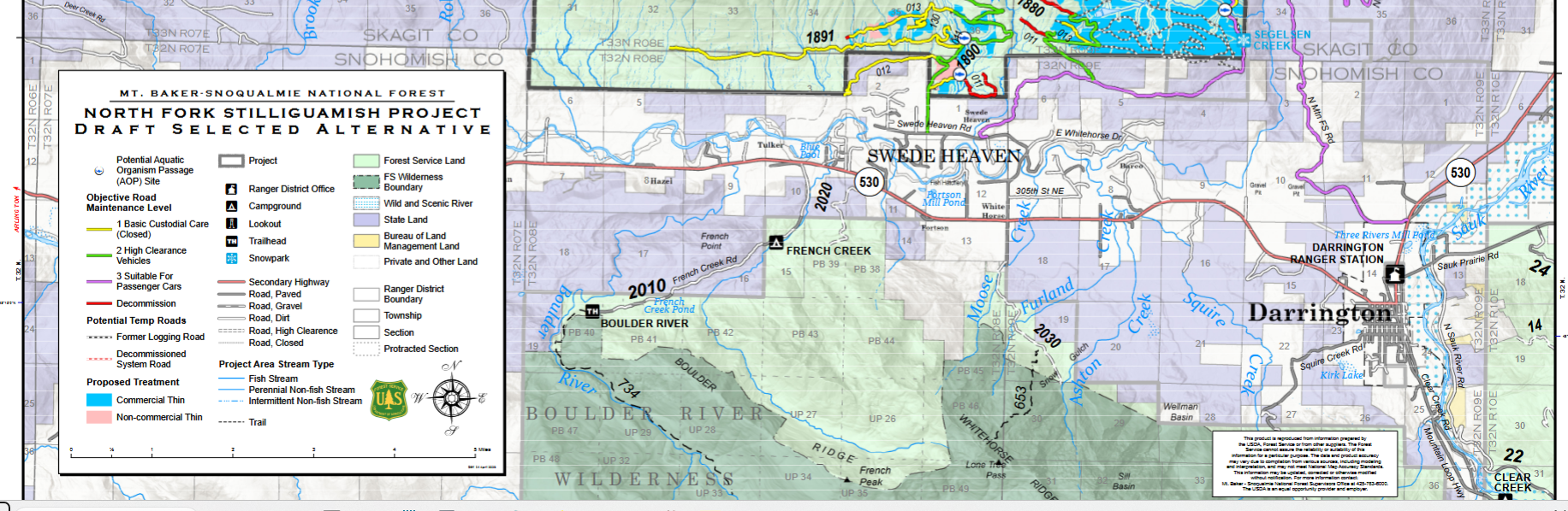
North Fork Stilliguamish – Draft Selected Alternative
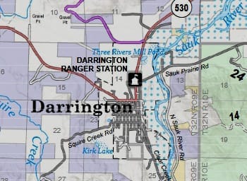
North Fork Stilliguamish Project Draft Selected Alternative, excerpt of Darrington area
Mt Baker-Snoqualmie National Forest
Roadless Area Conservation
Thumbnail of Inventoried Roadless Areas within Mt. Baker-Snoqualmie National Forest
Related articles
Comments ()